
By Techno Crat
Drone photography is the capture of still images and video by a remotely-operated or autonomous unmanned aerial vehicle (UAV), also known as an unmanned aircraft system (UAS) or, more commonly, as a drone.
An unmanned aerial vehicle, sometimes known as a drone, is an aircraft that does not have a human pilot, crew, or passengers on board. Unmanned aerial vehicles (UAVs) are part of an unmanned aircraft system, which also includes a ground-based controller and a communications system with the UAV.
In a crisis zone drones can be used to collect and deliver medical samples, supplies, and medications to remote or otherwise inaccessible places. Drones can also detect humans by their heat signature using infrared sensors, which is useful in search and rescue situations.
Drone photography allows images and audio/video to be captured that might not be otherwise possible for human photographers and videographers. That capacity can be enabled by the flight abilities of drones, their small size or their ability to tolerate harsh environments. Drone photography often enables a first-person view (FPV) that would normally be impossible to achieve.
There are many different drone sizes and designs, including fixed-wing with propeller or jet engine, as well as many rotor-based designs. Fixed-wing craft often have an edge on altitude and endurance but lack the manoeuvrability of rotor-based craft. Being often chosen for military operations, they are generally more threatening.
Flying robots
For all intents and purposes, drones equipped with computer vision, face recognition, object recognition and other tracking technologies are flying robots. Their increasing presence in the environment is enabled by the combination of networking, robotics and artificial intelligence (AI).
These advanced, AI-capable drones can adapt to their environment and perform many autonomous task, such as taking a drone-based selfie (also known as a “dronie”) or following an owner and taking pictures or filming while they walk around or travel in a vehicle.
Drone photography is used in surveillance to gain intelligence against enemy targets by government agencies in war and for competitive intelligence by businesses. It is used in journalism and also law enforcement, as well as for spying. It is also used artistically and in journalism to capture previously impossible or extremely costly helicopter photography.
How a drone camera works
A drone camera is designed to communicate with the controller on the ground. That way, the pilot doesn’t have to land the drone every time they need to adjust the camera settings.
To understand how both the drone and the camera work, we need to understand some basics about drones. To fly a drone, you use a controller. The controller communicates with the drone through Wi-Fi signals or radio frequencies. Most toy drones use Wi-Fi signals, but advanced drones mostly use radio frequencies. So, the same way the controller sends instructions on the direction to follow, how high to fly, or anything else it’s designed to do, it sends instructions on what the drone will do with the camera.
To effectively use a drone camera, you have to have some drone flying skills and some photography skills.
Types of cameras used in drones
Drone cameras have come a long way. Today’s cameras are advanced and specifically equipped to take high-quality shots from some distance above the ground. Whether you need a simple drone camera for photography or a more sophisticated one for specific tasks, there’s one in the market for you.
They also come with gimbals which help stabilize the footage even when there’s turbulence as the drone manoeuvres in the air. A good example is cameras used in top drones such as DJI, Yuneec, and Autel. Most can shoot footage 4K in resolution (With Autel robotics drones achieving up to 8K resolution).
Another fascinating feature about these cameras is the ability to zoom. This allows them to take shots from high altitudes without distorting the quality of the images.
DJI has a series of Zenmuse zooming cameras, with the latest managing a zoom of up to 180X. Such zooming power is helpful when the drone user needs to take shots of construction projects, electric stations, or turbines from a distance.
Uses of a drone camera
With the combination of a drone and a camera, drone users can now accomplish both hobbyist and professional tasks. Below are some applications where drone cameras are applicable.
Filming and photography
This is one sector that has heavily utilized drone cameras. Shots that relied on helicopters, cranes, and other sophisticated filming equipment are now being accomplished using drones. Besides filming moves, drones are also useful in journalism filming, especially in snowy areas, caves, or other areas where it’s inaccessible by foot or by vehicles.
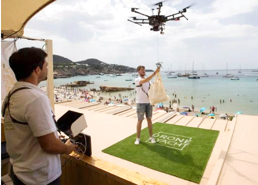
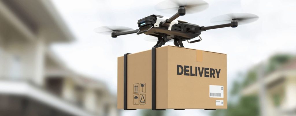
Delivery
From food delivery to parcels and other items, drones are now being used to deliver packages worldwide. Drone delivery has also been very prevalent during the Coronavirus pandemic. UAVs have been used to transport vaccines, get lab samples, and even deliver food as a solution to minimizing contact in an attempt to stop the spread of the virus.
Drones utilize a wide range of sensors, a camera being one of them, to identify where to land and be aware of its surroundings at all times.
Disaster management
Drones are also useful in disaster management, especially in areas where vehicles or people on foot can’t access.
Equipped with unique thermal cameras and sensors, you can use drones to track wildfires, gather data, and help fire-fighters make the best decision on how to tackle the fire based on real-time data.
It’s expensive and quite challenging to do this using a helicopter or other traditional data acquisition systems.
Research
Drone cameras are being deployed in sensitive archaeological sites where people can’t access. This opens up more possibilities in finding artefacts they couldn’t find before. A good example is National Geographic’s expedition to discover what happened to two mountaineers, Andrew Irvine and George Mallory, who disappeared on Mount Everest in the 1920s.
They used drones to film most of the area with an aerial view. Drones are also being fitted in rockets to assist in collecting data on other planets.
NASA’s Ingenuity drone used to collect data about life’s existence on Mars and relay it to Earth for further study. More drones for this purpose are also in development.
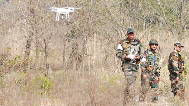
Surveillance and Monitoring
Drone cameras are helpful, especially by law enforcement, in surveillance, monitoring crowds, and even identifying threats.
This kind of surveillance is also vital in monitoring borders to prevent any criminal activities and alert authorities.
Military personnel also utilize drones to detect bombs, gather intelligence in enemy lines, and even launch attacks. This is possible because the drone pilot has a visual live feed of the area they are targeting.
Weather Forecasting
With advanced cameras and sensors, drones are now useful in collecting weather data such as humidity, wind speed, and temperature, which then helps in weather forecasting.
Land Surveying and Mapping
Drone cameras can be used to collect several shots over a large piece of land. These shots can then be used to create orthomosaics, 3D models of the terrain, or create topographic maps.
This makes it easier for land surveyors, geologists, and other map users to get up-to-date data on various landscapes with minimal cost and less risk.
Drone regulations in India
In India, before every operation of a drone, permission is mandatory. Drone operators can see permission via a mobile app (covered under the digital sky platform) which automatically grants or rejects the permission. The specifications of drones permitted for use in India require them to be incapable of take-off without permission.
Operators of drones must ensure that they comply with all these restrictions. Failure to do so could result in penalties, including a fine of up to Rs 1,00,000.
The Directorate General of Civil Aviation (DGCA) has released regulations for the operation of civil drones in India.
Registration and Licensing: All drones must be registered with the DGCA, and operators must have a license to fly them. Registrations can be done on the “Digital Sky platform” operated by the DGCA which provides a single-window online platform for drone registrations and approvals related to drone operations.
Operator Requirements: Operators must be over 18 years of age, have completed a training course from a DGCA-approved institution, and pass a written exam. Once the drone operation license is issued, it is valid for 10 years.
Restrictions on Use: There are restrictions on where and when operators can fly drones. For example, operators cannot fly near airports or in densely populated areas.
India’s ban on drone imports
As of February 2022, India has banned the import of all drones and components that can assemble to create drones. It is done to encourage the domestic drone manufacturing industry to become a global drone hub by 2030. Some exceptions are there to this import ban for the defence industry, security purposes, and research and development of the technology.
Drone pilot training
Drone Pilot Training is now mandatory to fly any drone above the weight of 250gm in India. Operating a drone without the mandatory certificate can result in heavy fines, confiscation of the drone you are operating and possibly even imprisonment.
GATI ensures that you develop the knowledge, skills and attitude to be a proficient drone pilot, not just for your current requirement, but also to graduate to higher category and more complex operations of drones. GATI also bring you the opportunities in the vast and rapidly growing drone industry upon the successful completion of your training.
At GATI’s Drone Training School, it has created an environment where in one week of training, one can get deeply immersed in the world of drones and the opportunities that come with it. One will be able to visualize the future of drones in India and the role one can play in it.


, also known as an unmanned aircraft system (UAS) or, more commonly, as a drone.)